
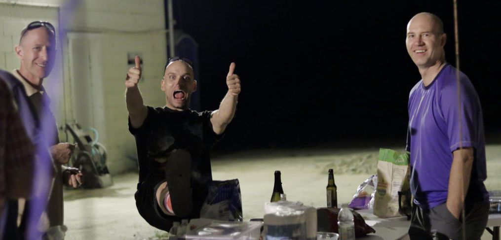
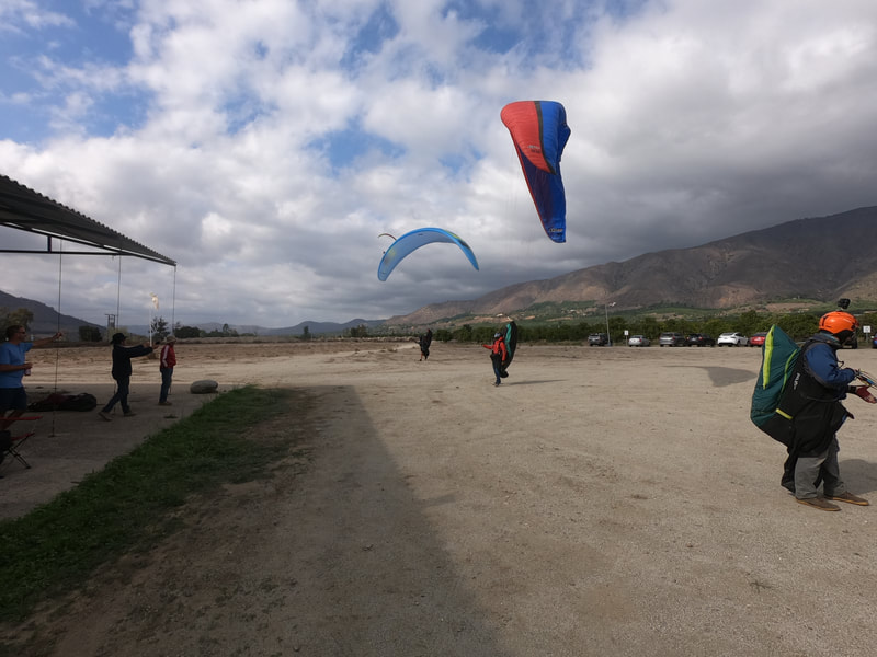
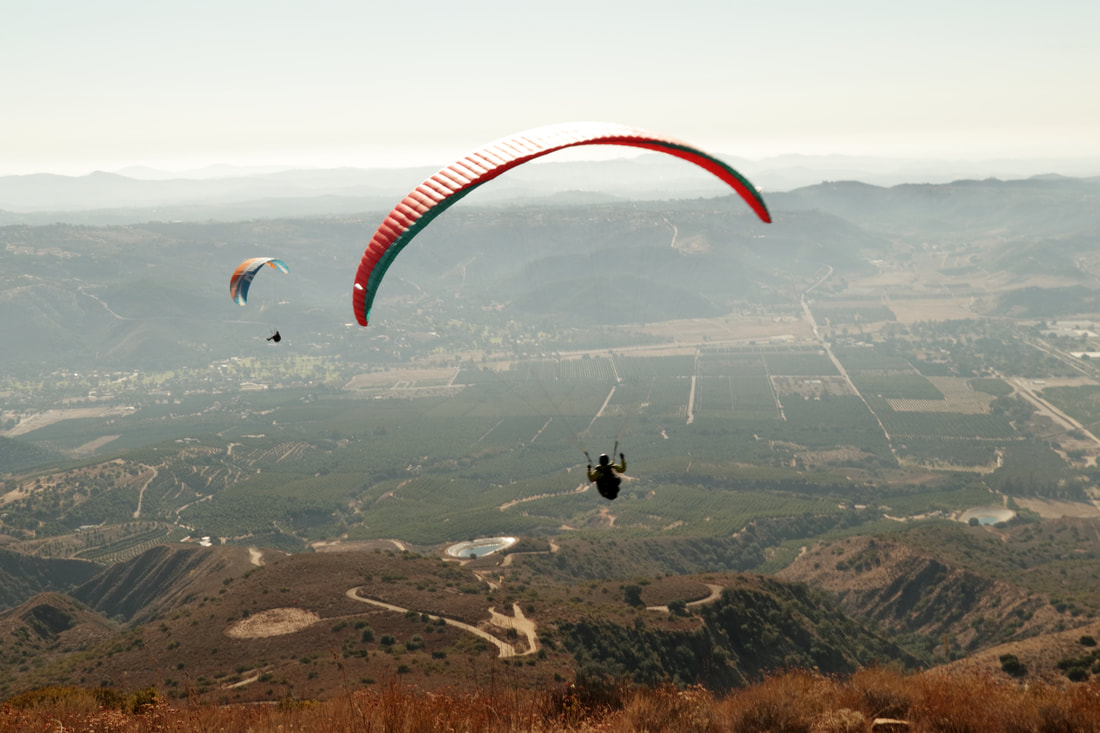
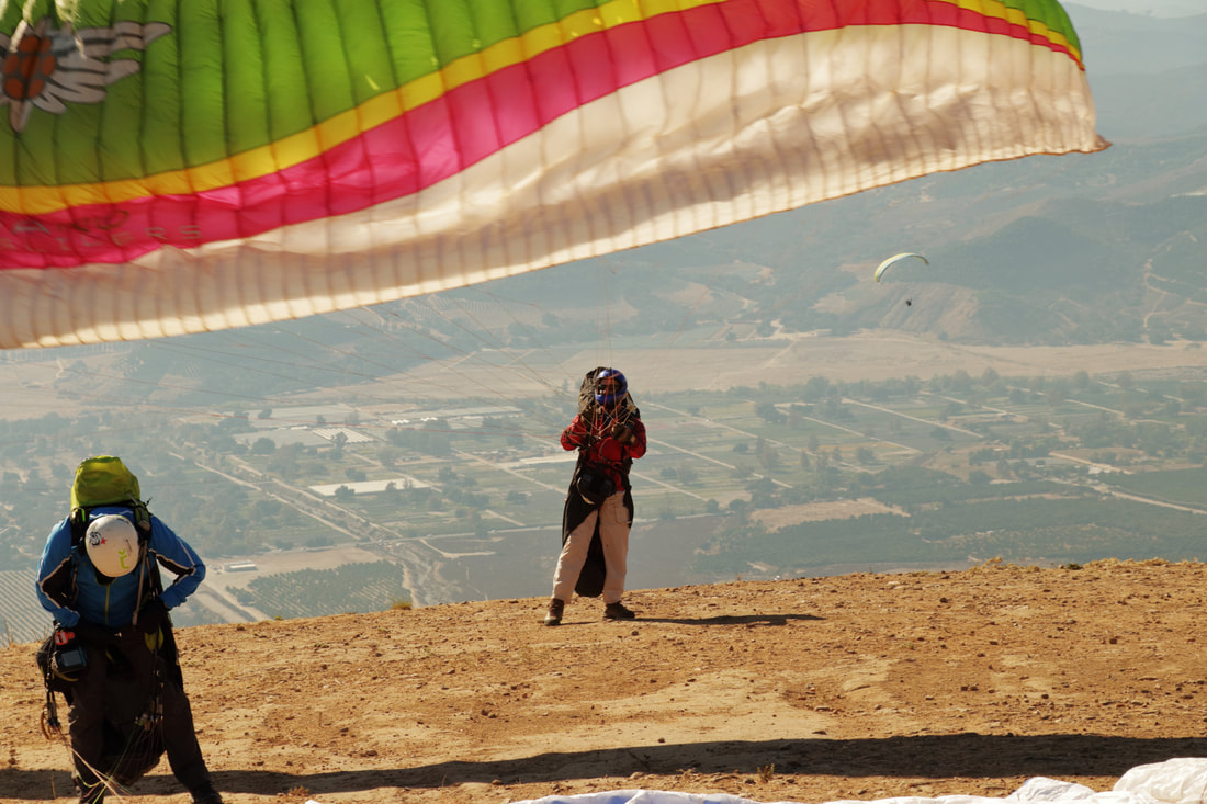
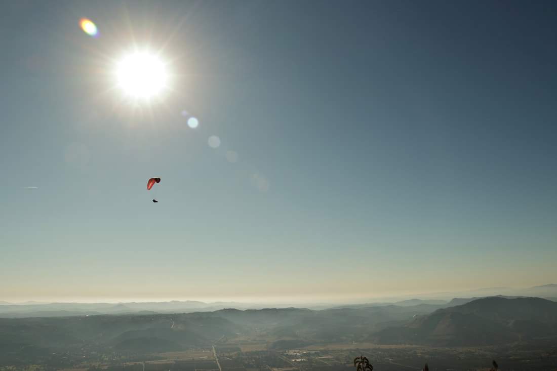
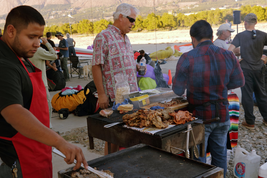
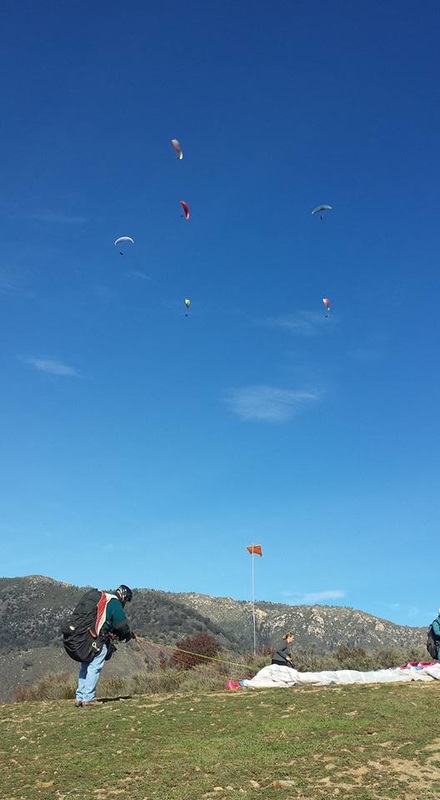
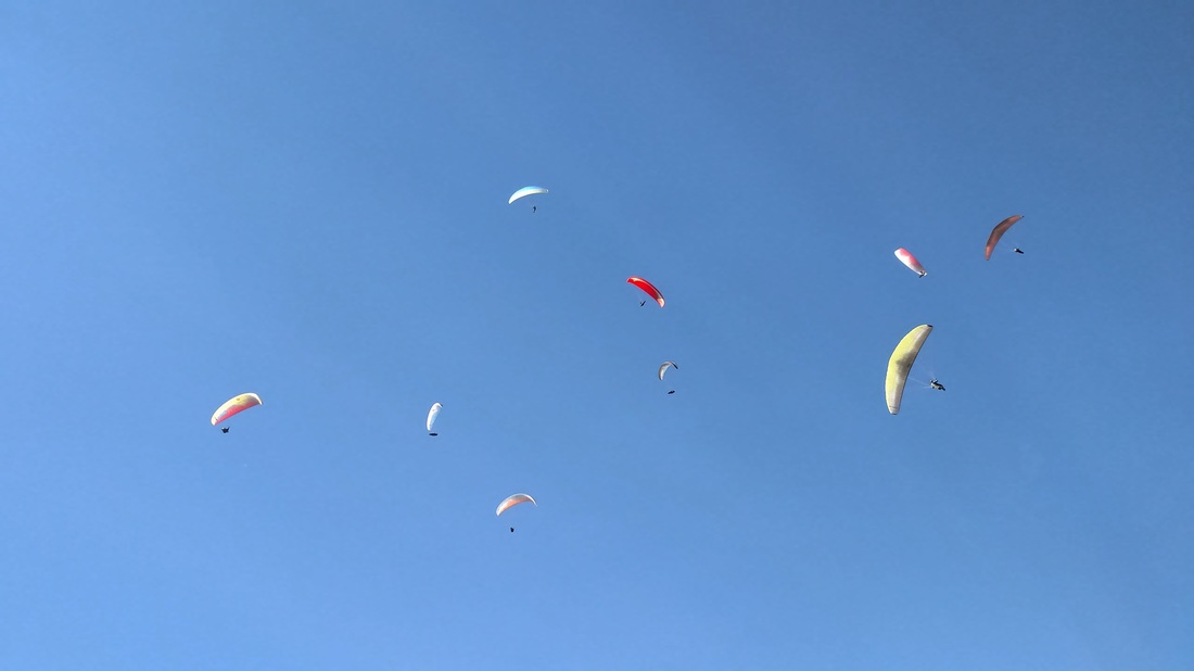
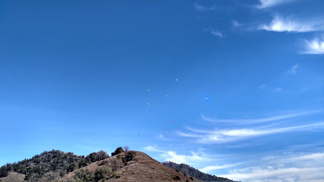
The Palomar Oct. 22nd Fly-in was a fun day with plenty of smooth lift to cloud-base all over the valley. The initial forecast predicted only a morning session since possible light precipitation would start in the evening, but the weather gods smiled on us and the sun came out and clouds lifted. The wind did start to pick-up around 2:30pm, and for those already on the ground sitting in lawn chairs enjoying tacos and beers, they got to watch the show as pilots maneuvered not to land short of the LZ in relatively strong winds. No orange trees were landed on!
|
An Intermediate Pilot's Journey
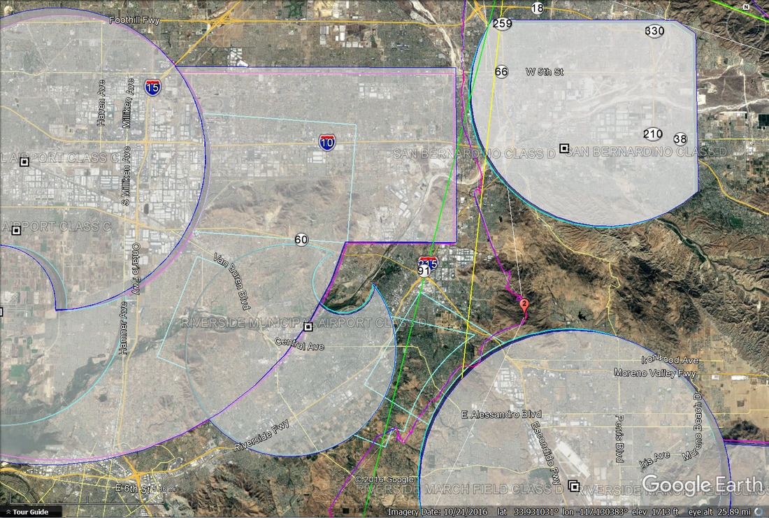
Elsinore convergence animation / slideshow hr by hr From XC Skys on a classic day 9-27-18 starting at 9 am till 6 pm. Watch how the day develops and progresses. The colors are showing top of usable lift and the scale is on the upper right. From blue to green then yellow are the higher altitudes. Note that the Eastern side of the Santa Ana Mts / Santiago Saddleback coastal range (that block & hold back the westerly winds and also referred to the E's Back Range) typically develop 1st before the flats heat up to be workable. Many times, it becomes a patience & waiting game while trying to hold onto altitude before crossing over into the flats. A lot of times, it is beneficial to hold onto the Back Range until the West pushes through. Once the west pushes through, it is time to go with it and try to stay slightly ahead of it as a tail wind, as the cooler west diminishes the Back Range's productivity, and the Flats turn on. Elsinore Air Space Notes: 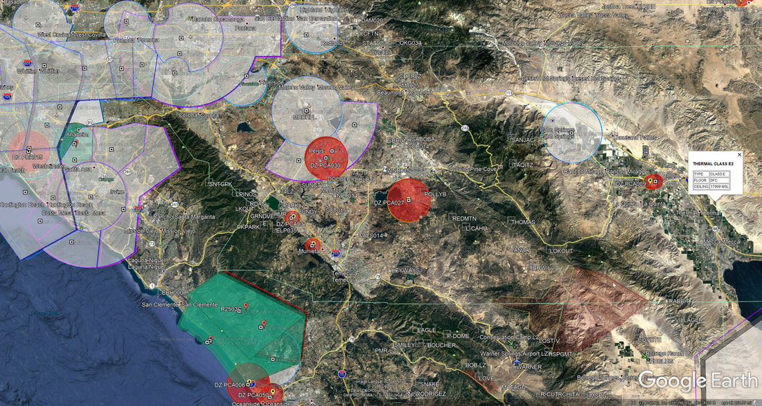 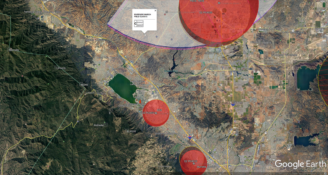
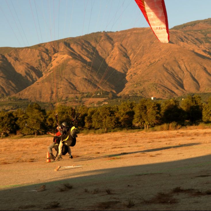
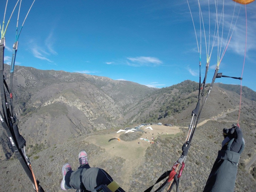
It was a flight just like any other, until it wasn't.
On May 5, 2018, flying my PG on the north side of Palomar Mountain, I deployed my reserve. This is the story.
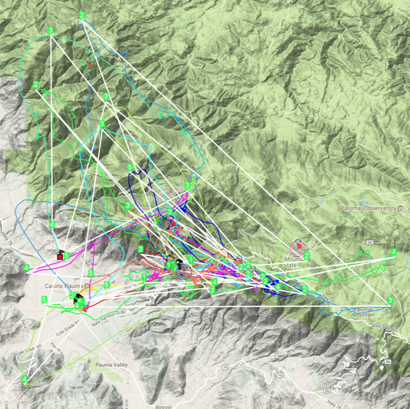
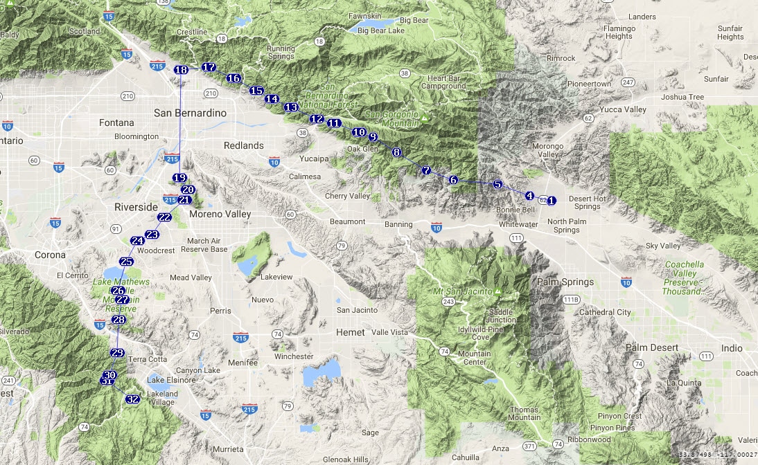
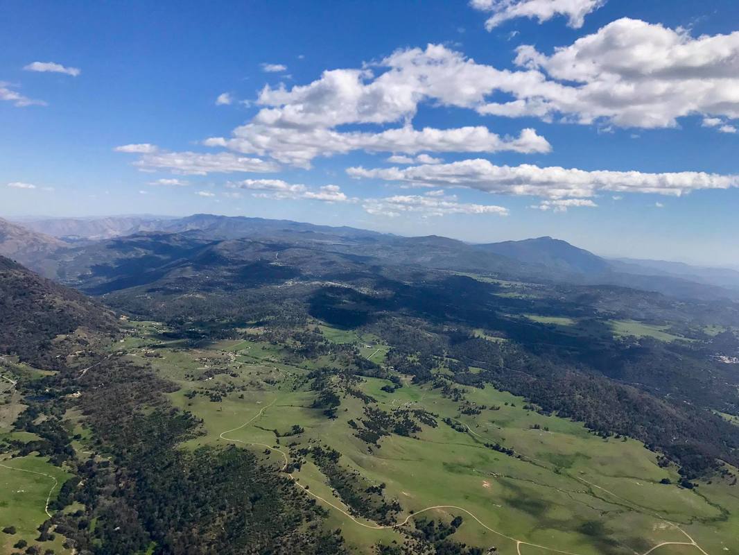
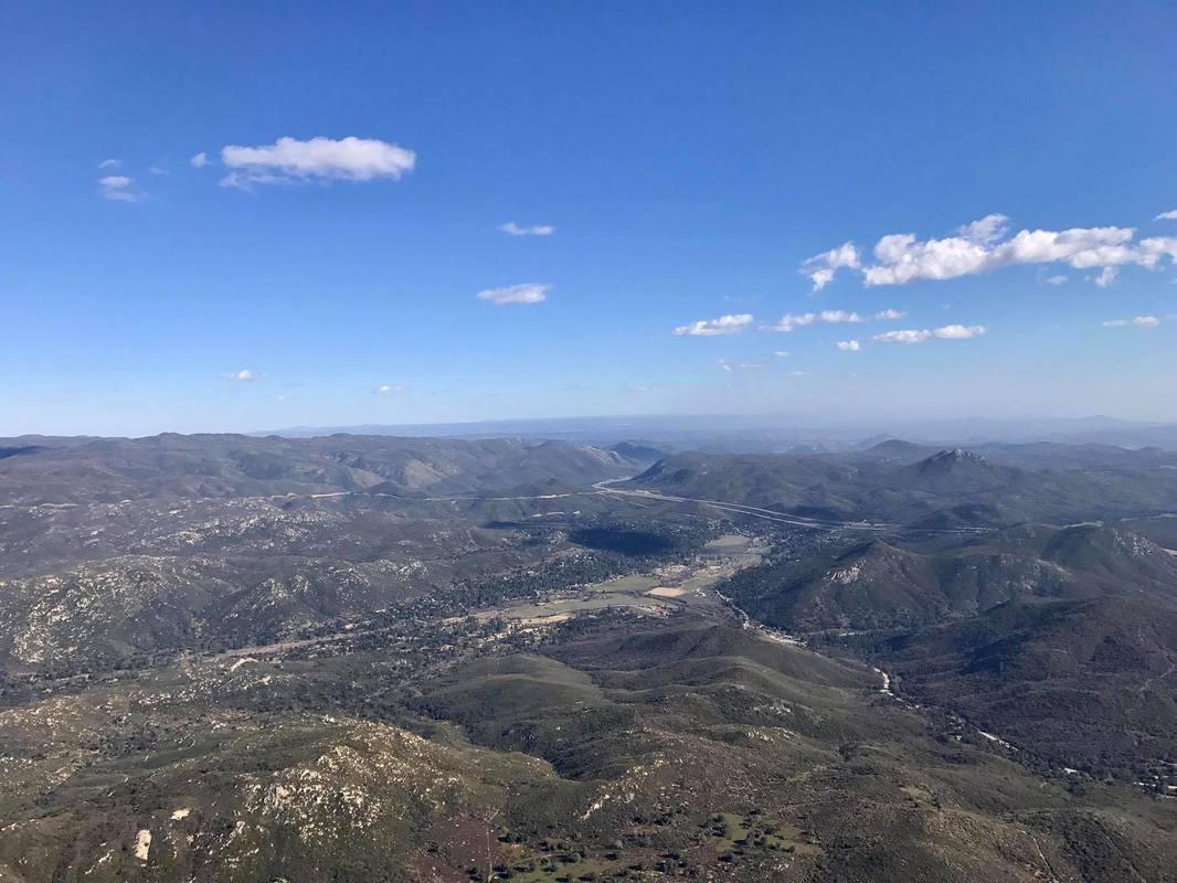
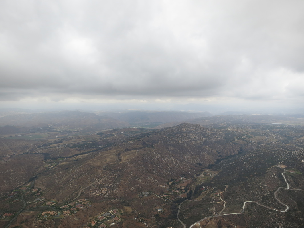
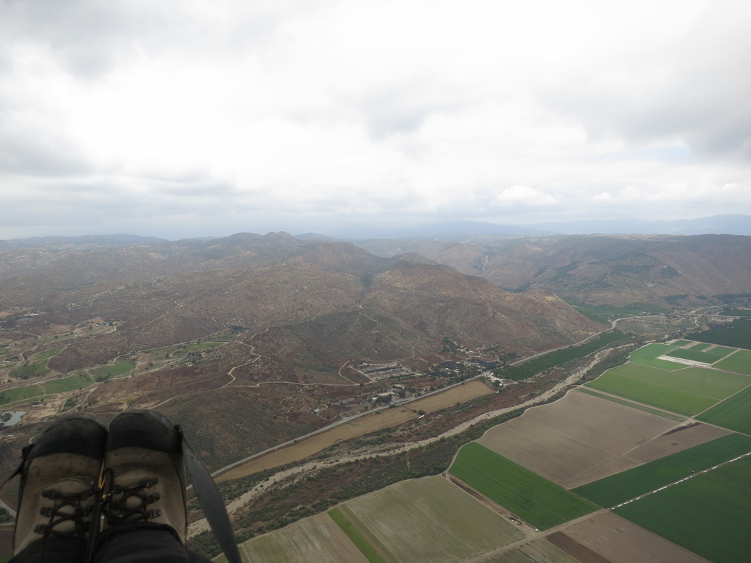
Steve Rohrbaugh, Josef de Beer, Steve Prairie and I met in the Palomar LZ just after 11:30. It was already hot, light breeze out of the west, and scattered high clouds. We headed up to launch in Josef's car. I had just been expecting to site fly, but Steve R thought big XC might be possible going north. He wanted to fly to Marshall. I didn't think I'd be able to keep up with him or Josef or Steve P, but it would be fun to try. I fly an Advance Epsilon 7, a B wing, with an unfaired harness, and the three other guys were in pod harnesses with C or better wings. Up on launch, things looked good. Wind was variable, but direction was usually good, with the wind mostly light but occasionally strong. I was ready first, and launched at 12:51. I found lift right in front of launch and started thermalling up. If you want to follow along, this Doarama (http://doarama.com/view/2115273) captures Steve R's, Josef's, and my two GPS recordings.
For whatever reason, in those first few minutes, I decided to feel for my reserve handle, and re-familiarize myself with just where my hand needed to be to grab it. I told myself that it was something I should be doing every flight, but I had gotten out of the habit. Premonition? I don't know. But I'm glad I did it.
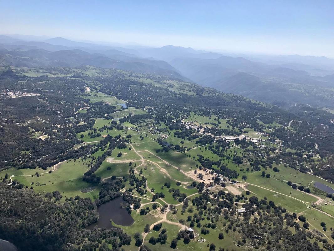
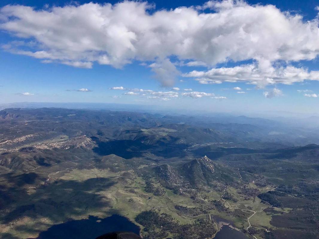
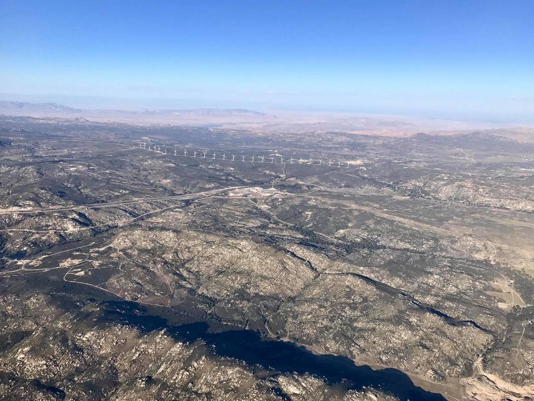
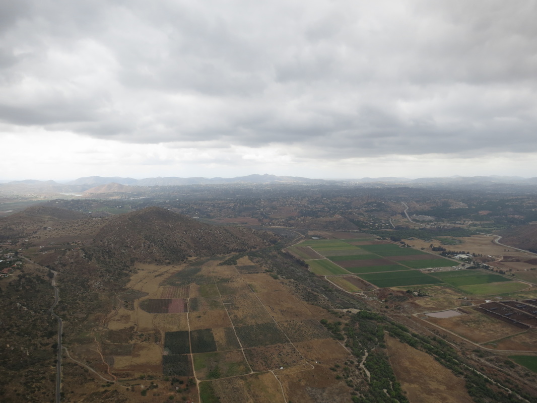
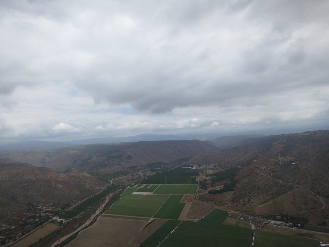
I was in a good thermal, drifting out of the west, but at 7100 it felt like the thermal, and the west push, stopped. It felt like I hit a different layer of air, maybe east coming over the back. I decided to head northwest toward Eagle Rock. Before I got to the next ridge line, I found thermals again drifting out of the west. At 7300 I headed north over the spine of the mountain, where I found a thermal that started drifting out of the east above 8100. I topped out around 8800, and started heading NW. I got to Eagle Rock at 7700. Beyond it, I found nothing but sink and turned around to try to tank up on altitude. Josef and Steve P streaked past me going NW, south of me and 500 ft higher. I wasn't finding lift where I was, so I decided to follow Josef and Steve P anyway. I watched Josef hit some really bad sink as he approached what looked like the NW end of the range. He started heading more north, and soon found a good thermal, and Steve P joined him. I wanted to join them too, but didn't think I had the glide, so I headed north before I reached them, and found my own weaker thermal. I gained 400 ft before it petered out. At this point I was really perplexed what to do. If we tried to go NW, we were fighting the west. It was an over an hour into the flight and I was maybe 5 miles from launch. Maybe this wasn't going to be a big XC day. The last good lift was back before Eagle Rock. I decided to head back that way and hope to get high enough to make the next move. I left with 5600, but as I headed back, losing altitude, I decided it was too risky to be low on Eagle Rock trying to make it back toward launch. So at 5300 I turned northeast, heading for what looked like landable ranch land on the way to the 79. I started hitting big sink. I began to think I would have to land at the ranch furthest in. At about 1000 AGL (3700 MSL) I got my low save, a nice 200-300 FPM thermal drifting out of the west. As I climbed, it got stronger, 400, 500, up to over 900 fpm. About 2 minutes before it all went to shit, I actually thought to myself "For a 1000 fpm thermal, this is really smooth. One of the smoothest strong thermals I've been in in a long time!". I had it centered, wasn't hitting any rough edges, and was rocketing up. As I climbed above 8k, I started contemplating my next move. I could see Steve R to the east of me, slightly higher, heading north. I also saw Josef about my altitude, but back to the south.
As I climbed through 8500 the lift was weakening, but I was still climbing at 200 fpm, still smooth. I saw 8800 on my altimeter and then I heard my wing rustle and I went weightless.
Now I should say that I really, really wish I noticed everything that happened in great detail and remembered everything that I did, in the proper time line. But I don't. I remember thinking at one point that I was two seconds behind everything that was happening. By the time I realized what the wing was doing, and thought about what I needed to do, the wing was doing something else. So I realize that what I report may not make sense, because I could have the timeline wrong. And I make no claim that I reacted with the right inputs at the right time. I will admit that as a pilot with lots of experience in the normal flight envelope, once I got outside that envelope, I was a bit lost. I very well could have made the situation worse. Or I could have just failed to adequately correct. Or maybe I hit turbulence that would have gotten the best pilot's wing folded up. I honestly don't know.
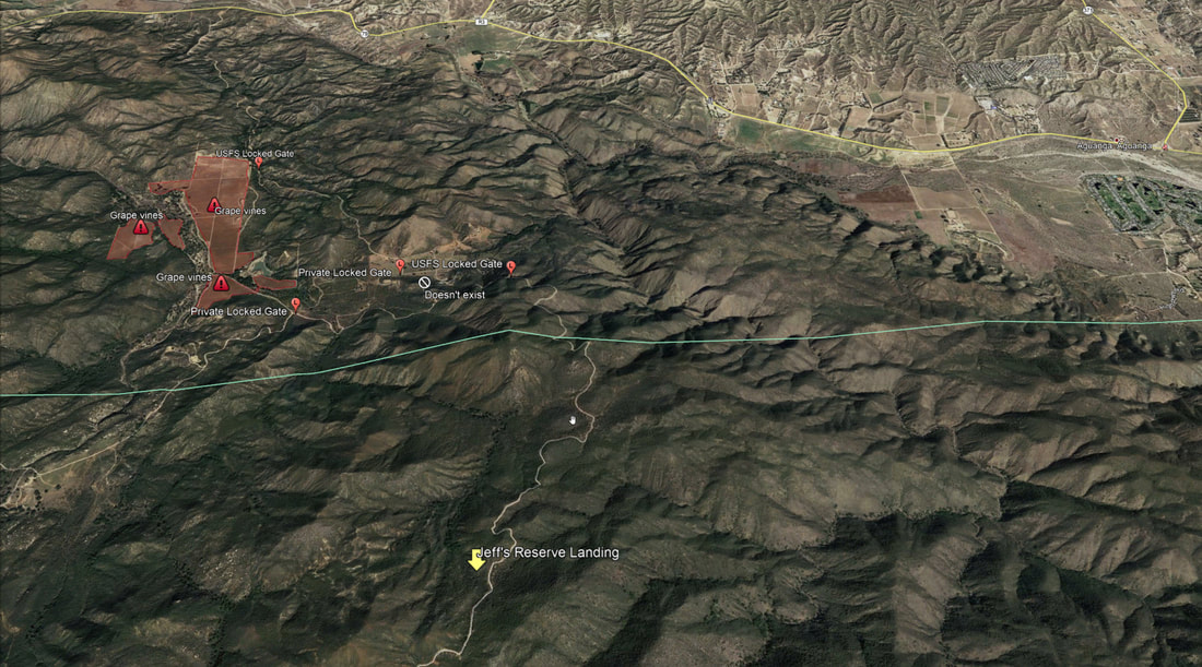
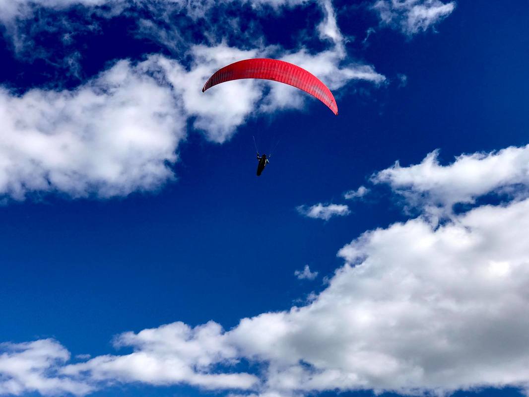
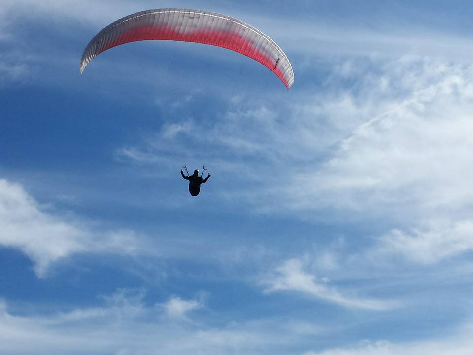
Anyway, I went weightless, and it felt like I dropped about 6 feet. I remember thinking "Oooh, that was a big one", but I wasn't terribly concerned as the harness picked up my weight again. But that was immediately followed by what felt like getting whipped around (or maybe I went weightless on one side of the harness). I grabbed the risers out of the instinct to grab something to hold on to. I know, not the right reaction. And then some moderate G's and then I watched my wing fly down in front of me, below the horizon. Luckily it didn't keep going past about 20 degrees below the horizon, but I thought "Oh Shit", like when you're at the top of the roller coaster and you know the fall is coming. I knew I was going to fall down between the lines, and I tried to remember the right thing to do. I thought, you've got to time some strong brake input to keep it from surging again. So what happened next is a bit of muddle. It seemed like before I could make that surge correction I was planning, I was getting yanked around. The next clear thing is that I was in a spiral. As I spun around, I could see the wing about 30 degrees above the horizon, pointed mostly down at the ground. The left half of the wing was folded under. I knew that I was dropping fast, but I also knew I had been at 8800 feet when this started. I knew I had some time to try to fix the wing, but I also remembered the warning about pilots blacking out from g-forces in a spiral before they could throw their chute. I didn't feel like I was anywhere close to blacking out, but I also thought to myself that I should not go too long before hucking. So I tried to fix the wing. The left wingtip was kind of balled up, tangled in the center lines, flapping. I pulled a lot of left brake, hoping that might pull the wing out of the tangle. Nothing happened. I started to look for the stabilo line, but started to think, "I don't know if that will untangle that mess, maybe I should just chuck the reserve". Right then Josef yelled over the radio, "Throw your reserve!, throw your reserve!" I thought, if I'm not sure I can fix this, and someone else thinks I can't, it's time. I reached for the reserve and pulled. It was harder than I expected (the G-forces increase the pressure the deployment bag is under). The handle came out, but still no chute. I had just pulled the handle out to the extent of the web strap connecting it to the bag. So I grabbed the strap and pulled again. I'm thinking "Throw the reserve into clear air", but all I had in my hand was flapping fabric. I'm wondering what happened to the reserve when poof, it opens and everything slows down. I'm guessing all this took about 4 seconds (from deciding to pull to getting it out). OK in my situation, but way too long if I had been close to the ground. From the GPS track, I'm guessing the chute opened at about 7400 feet. And it was about 50-60 seconds between the first collapse and chute opening. My maximum descent rate was over 2400 fpm. Once I was under canopy, I radioed to the others that I was under canopy, was OK and was going to land on the north side of Palomar. Both Steve R and Josef started flying in my direction to be ready to mark my landing location and assist if they needed to. Under canopy, the glider was winding itself up. I don't think I had a riser twist when I hucked (I'm not positive), but by the time I established that the reserve was open, the risers had twisted, and as the wing flew in a spiral (the left wing tip was still stuck in the middle lines) it was twisting all the lower lines into a rope. This was a good thing, I figured, because if it kept going, the wing would be forced smaller and smaller. As it was, sometimes the descent was smooth, other times the wing would grab some air, yank me forward, and create some penduluming between it and the reserve. As I got lower, I grabbed the "rope" of twisted lines, and started hauling the glider in. I got to the end of the "rope" where the lines fanned out, and wasn't able to grab the fanned out lines, so I stopped hauling in, and started thinking about where I was going to land. With incredible luck, I was heading straight for a dirt road. I actually thought I might land right on it, but in the last 500 feet, the wind shifted from west to north, and I missed the road by about 50 feet. I remember thinking, bend your knees, get ready for a PLF, and roll with it. As I got to 50' AGL, I realized that the slow spin of the reserve meant I was going to land going backwards. At about 15', I looked over my shoulder and saw a bathtub size boulder right where I was headed. "Oh fuck", I thought. I let go of the wing, heard branches crack, and then I was on my back, heart pounding, looking up at the sky, with no pain. Kind of comfortable, as a matter of fact. I immediately radioed to Steve and Josef that I was down, was OK, and if nobody saw me move for a while, don't worry, I was just going to lie there for a minute and catch my breath. And I did. I was very lucky. I had been set down right in between two boulders. My only injury was a slight scratch on my right elbow from one of the boulders. By landing backwards, my harness (stuffed with my camelback, hat, and glider bags) took the brunt of everything. Josef radioed that he was going to fly back to launch, get his car, and come get me. Luckily, I had cell coverage, so I was able to identify the road I was by (Cutca Valley Truck Trail), and radio the details. I even called my wife to let her know what happened, before she heard any rumors from someone else.
Then I had to decide what to do next. My reserve had drifted over some bushes to the south, and my glider was hung up on bushes to the north, with my harness in between. The bushes were 6-10 feet tall. I thought it would be almost impossible for me to gather the wing and chute without help. Besides, I was just not up to it.
I admit to being surprised at how much the whole thing affected me. For up to half an hour, I was literally shaking. I had only been flying an hour and a half, but I was very tired. The adrenaline rush had taken a lot out of me. For reasons that make no sense now, I wanted to get to the road in case someone came by. I thought, find a clear path to the road, take out a manageable amount of gear, and then come back for the harness, glider, and reserve. So I grabbed my helmet, instruments, water, and jacket, and looked for a way to the road. It is hard to convey just how thick the bushes were. I spent a few minutes trying to see if there was an obvious path out. No. I put on my gloves and started breaking branches to clear a path. It literally took me about an hour to make it 50 feet to the road. I got more scratches from bushes than from my landing. By that time, Paton W had stopped by the Palomar LZ, heard what happened, and volunteered to drive my car to come get me. That was great news.
My plan had been to drop the first stuff at the road and go back for the glider, reserve, and harness. But I had no energy for fighting my way back through the brush. Also, I worried that the road I was on was behind a locked gate. So I decided to start hiking out, and come back for the glider later. I turned on location sharing on my phone, and started walking.
The next day, I recruited my son-in-law, and Josef volunteered as well, and we went back. With the three of us (and brush cutters) it was pretty easy to retrieve all the gear. Even so, it was a long day.
So, what do I conclude from all this? One, I was very lucky. Lucky that I had altitude. Lucky that my chute worked perfectly, even if I didn't. Lucky to not hit anything hard on landing. Lucky to be so close to a road, in bushy but moderate terrain. As I hiked out, I saw plenty of other places I could have landed that would have been hell to get out of. Lucky to be flying with friends who saw what happened and helped out.
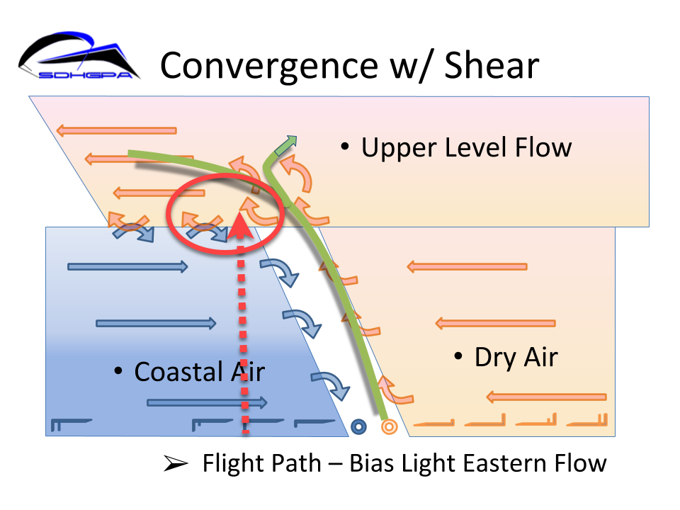
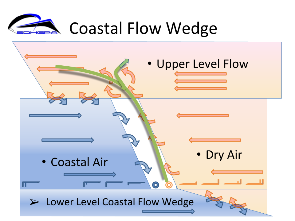
So, what the hell caused all this? I think all day, we were seeing different layers of air moving in different directions. I'm guessing that at 8800', I hit the east shearing over the lower level west. But I don't know for sure. The more interesting aspect of this whole thing is how I performed. I didn't panic, which is good. I don't think I did anything terribly wrong, but I'm pretty sure I failed to do some right things when they needed to be done. We all like to think we have "the right stuff". Maybe some of us don't. My one and only SIV clinic was in 2011. Way too long ago. In fact, my chute hadn't been repacked in a couple of years. It's easy to get complacent. As for the future? I don't know. I love XC. But something like this changes the risk/reward calculation we all do when we decide to fly. Next time I might not be so lucky. My instinct is to jump back on the horse that threw me. But it gets really hard to say "It won't happen to me" when it's happened to you. Jeff Brown 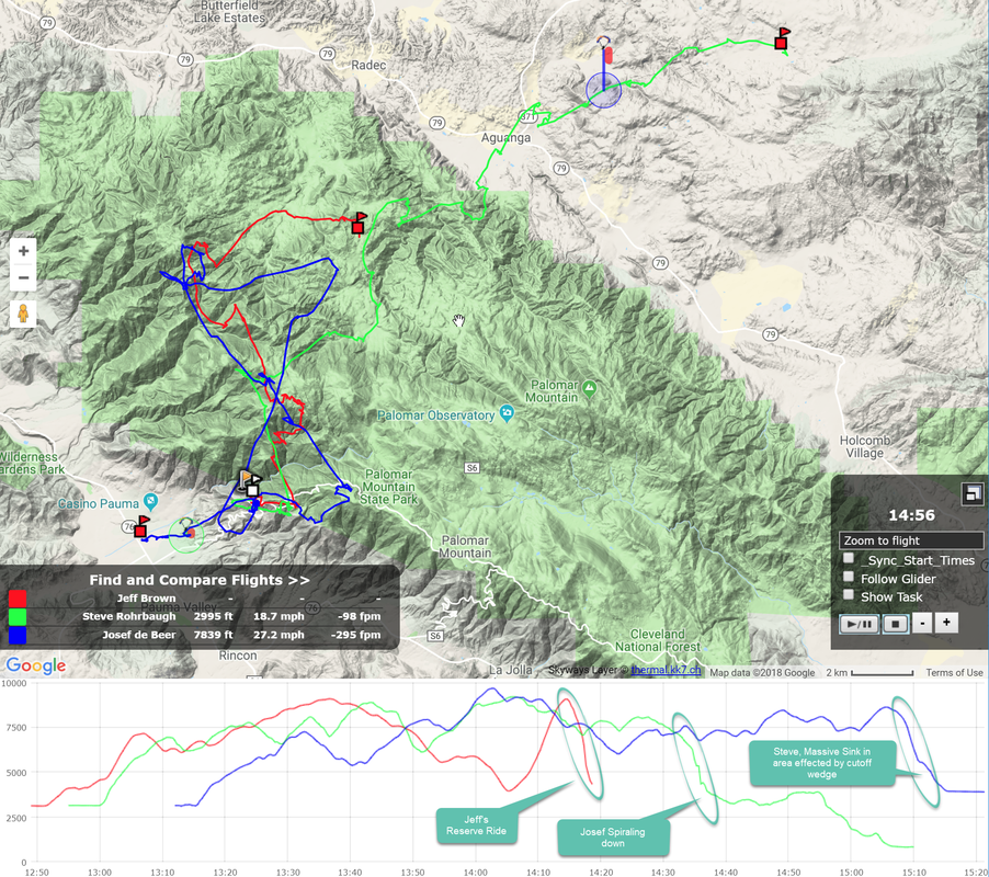
Steve R's side bar comments: Jeff is correct in speculating that he had hit a strong East shear overriding the West at around 8.5-9K.
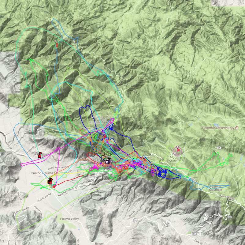
If you view Jeff's track, Jeff was thermaling up in the west side of the convergence. The thermal that I had prior to Jeff's but more south east of Eagle Rock was similar. We were Thermaling up in the westerly coastal air mass flow in areas that were protected from the stronger lower level winds. North into Temecula and flowing up the Aguanga Valley was the typical lower level winds that scrub and cut off the thermals. The trick for this route is to make the jump from the West side to the East side of the Convergence before the lower level cuts off the thermals, or make the jump over areas under the influence of the lower level cutoff wedge.
Jeff's thermal path (Red) location graphically in relation to the main convergence line.
My own thermal, like Jeff's, was the strongest thermal of the day for me and I had heavy banked up in it to load the glider in this thermal. As I was passing through this shear layer, my own glider was heavily being pitched and surged to the point of almost doing asymmetric spirals while while thermaling with active piloting and still going up 500-800fpm. In strong thermals and potentially turbulent ones like this, I find it is best to throw efficiency out the window and load up your glider in a high banked turn with lots of wt shift.
Followup note from Jeff:
I had a good chat with Phil Russman about what could have been happening with my wing during my incident. He said a big surge (wing flying down past the horizon) is usually caused by stalling and/or spinning the wing. I doubted that scenario because I never pulled a lot of brake. In fact, I was thinking "get your hands up" and don't pull a lot of brake. So that led Phil to propose that probably, some part of the wing collapsed and got behind me, and then as I fell and re-loaded the lines, it started to shoot forward just as I was putting my hands up. That sounds very reasonable to me. So, as far as the first part of the incident, I made two mistakes; not looking up at the wing to see what was going on, and releasing the brakes just when I should have been applying them to stop the surge. After the big surge, when the wing was below the horizon, I think that the line-loading went to zero as I fell down between the lines. Probably, with the wing completely unloaded, the left wing tip folded under. Again, I didn't keep my eye on the wing. If I had seen the cravat and immediately applied right weight shift and some right brake, I might have kept the wing from winding up into a spiral. Phil says once you have a "stuck-tip cravat" wound up in a spiral like that, it is very difficult to remove. Even if right weight shift and brake couldn't keep the glider flying straight, a slower turn and lesser G forces would have given me time to find the stabilo line and try to pull the cravat out. Given the first couple mistakes, once the glider was wound up in a spiral with a stuck tip, throwing the reserve was the right thing to do. My intent in writing up my account is not to suggest that unknowable crap will happen to your glider while you're flying. I believe that if I had reacted promptly and correctly, I would have lost a bunch of altitude, but not had to throw my reserve. My intent is for all of us to learn from my mistakes. Jeff
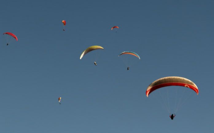
Was a great success! All had great flights & a great time!
Need not to say any more than what can be expressed in photos & video of the day. 2018 SDHGPA Fly-In from STEVE LAMOUREUX on Vimeo. A brief collection of drone shots from fly-in event at Palomar Mountain, later in the day.
Day of the Triangle
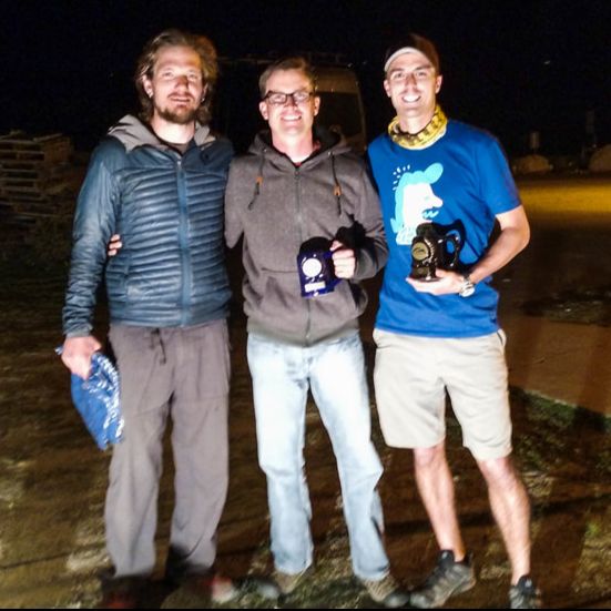
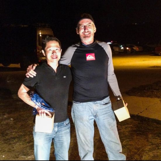
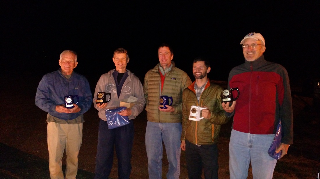
2017 XC Competition Awards:
Lost & Found:
There was quite a big list of items left behind & found at the Fly-in. A key thing for Palomar, especially after fly-ins, is that we leave no trace. Items collected at the end: Heavy gloves, Camp Chair, small Cooler, Radio in the HG set-up area. They will be at the next meeting or can be picked up from Steve R in Carlsbad. Also lost by Gary Oddou but not found was a Galaxy Note 4 lost possibly on launch west of the windsock.
Palomar October 28th Fly-in Report
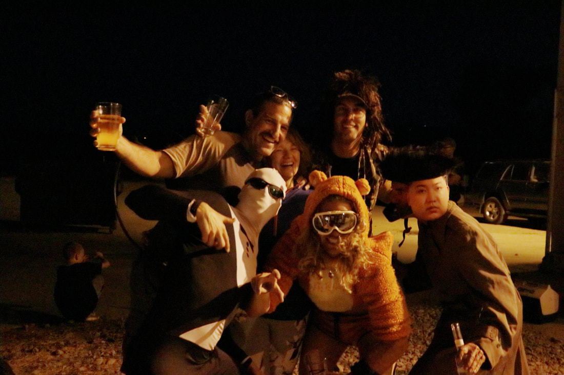
The SDHGPA Fall Halloween ICARNAVAL Fly-in's location was changed from Horse to Palomar due to all weather models forecasting NE winds out at Horse. This set in place some late logistic gymnastics for the large Fly-in. We are super thankful to all those involved to make this switch possible including the Pala Tribal Counsel for squeezing the approval in to their agenda the day of their meeting.
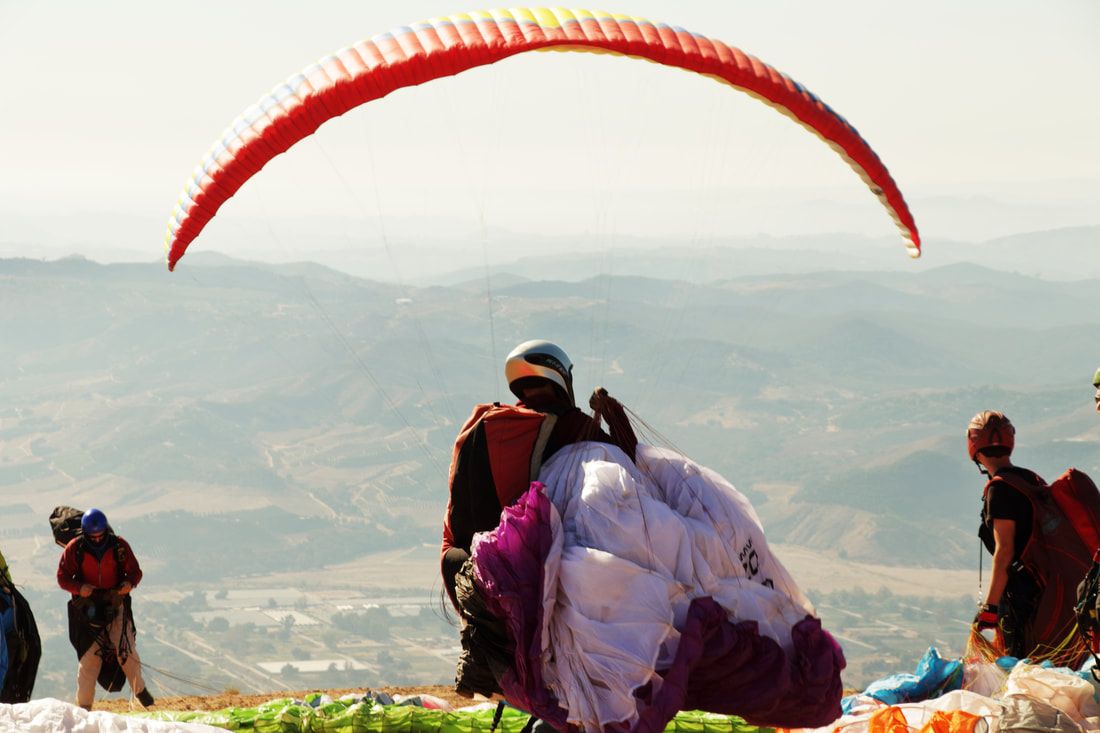
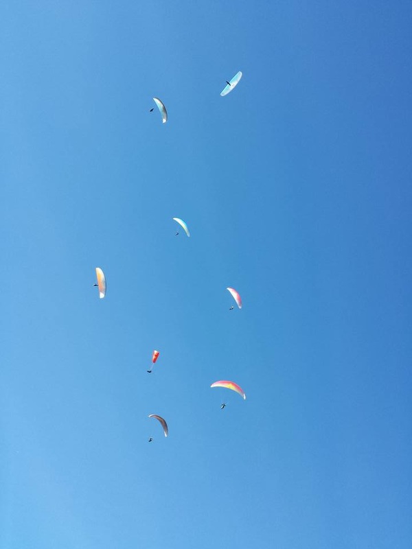
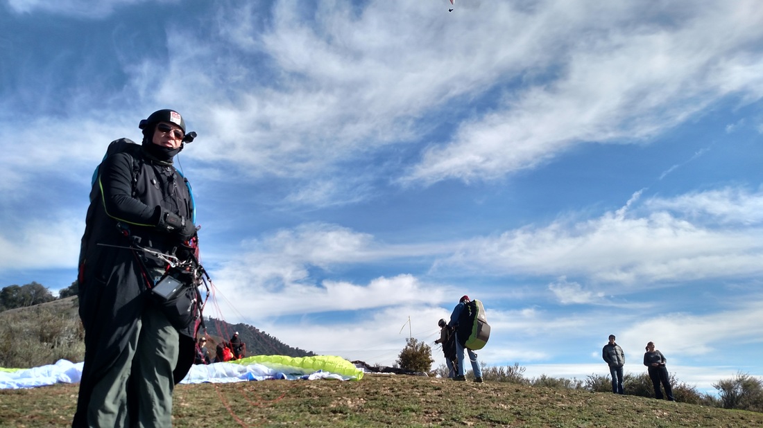
It turned out to be a beautiful day at Palomar on Saturday, the day of the fly-in. About 60 PG pilots along with two HG pilots (Erick and Rich) flew. Scott set up but had an aileron problem and ended up tearing down.
A few pilots struggled up and down a bit. However, most everyone had multi hour flights, getting between 2,000' and 3,000' above take off. Landing conditions were very nice, maybe 7 mph and parallel with the highway from the NorthWesterly direction. That makes for a long and level usable runway.
Winds on launch were light with mostly pure thermal conditions cycling in. This made launching conditions at times quite challenging due to the light base wind being overpowered by prevailing thermal activity creating thermal blocking on launch.
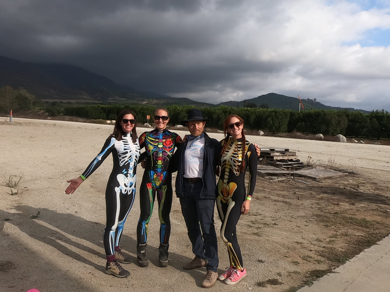
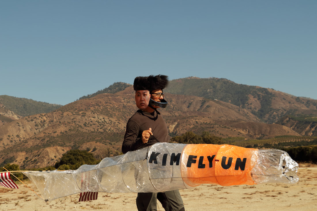
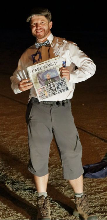
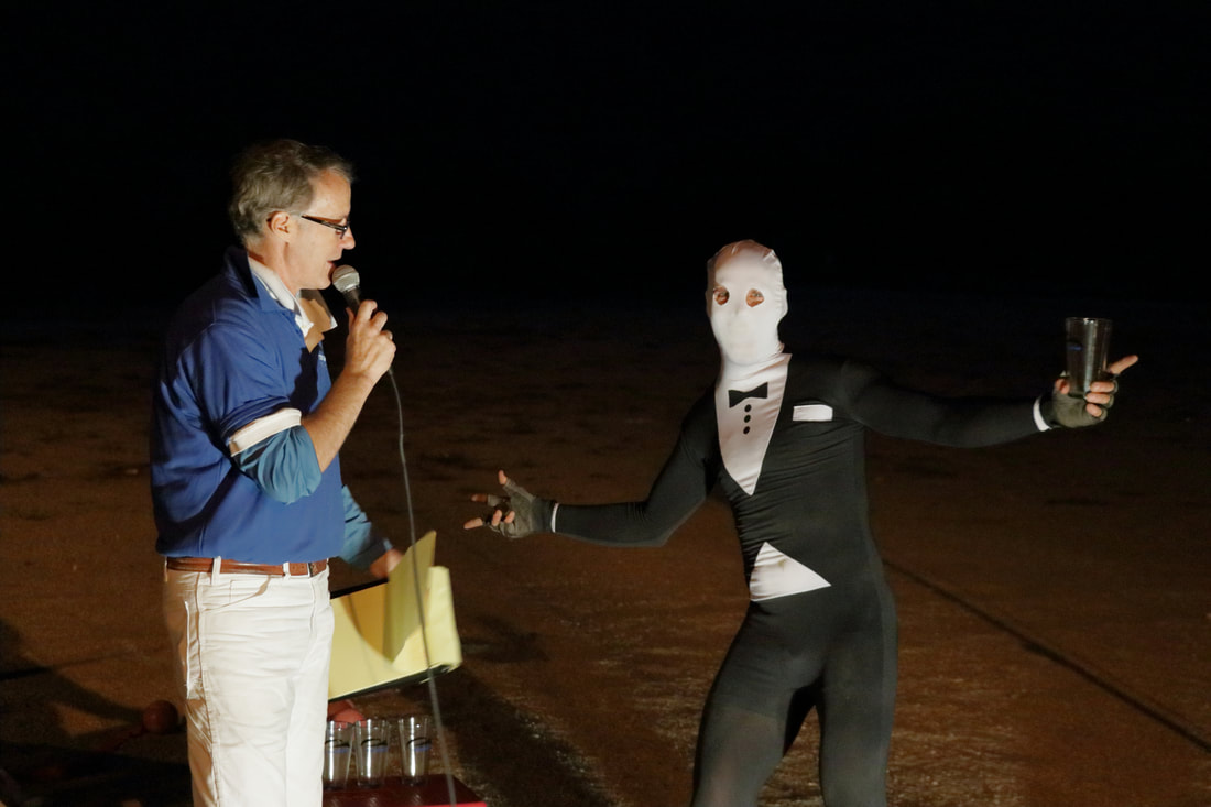
- the Masquerade Flights -
Some Great Costumes on the Ground & in Flight
Costume Award Winners:
Other Contest Winners:
All in All a Great time:
Gary Earl was at the Pauma Casino for the afternoon and came over to shot some great photos after seeing us in the air by chance and has been kind enough to share.
Steve R also uploaded over 150 additional photos to those shot by Gary to following Gallery for viewing & download: https://photos.app.goo.gl/I3Gsl4IPMvrViD8d2

Again, A Big Thank You to all those that helped out to make this Fly-in possible including the Pala Tribe & Roberts Ranch for allowing us to enjoy their great site especially with that late notice of our site change.
Looks like the the XC Season has opened & SDHGPA Site Records will not rest again this year! The E Chris Cote just re-set the bar for the E to 54.5 straight line miles on 4-5-17. With a clean ~ straight line to Marshal, then down range to Desert Hot Springs. Each leg a nice flight in its self. Not the easy route through. . . Well done. http://www.sdhgpa.com/-xc-records.html
Big Black This past Saturday 4-1-17 was no April Fools day at Big Black and 2 site record flights were recorded for the day. Chris Cote held the site record for 65 min of 34 straight line miles landing near Barrett Lake. Chris & Phil were team flying most of the way but Phil Wessinger fell slightly behind at Cuyamaca and their routes diverged. Phil persisted and held on to Horse and was able to get re-established into the convergence and flew on to the Mexican Border near Tierra Del Sol taking the site record of 48.3 straight line miles. (Photos & Photo Comments - Phil Wessinger) When Flying XC, Fly Safe . . . and things to do in Preparation:
To qualify for SDHGPA Site Records and SDHGPA XC Contest:
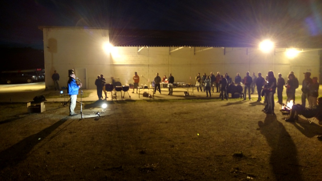
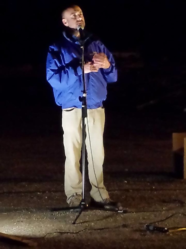
What a great way to start off the 2016 new year with yet another great fly-in at Palomar!
A BIG THANK YOU!!! to ALL of the FLY-IN VOLUNTEERS!
First off, I would like to extend a big thanks to all those that pitched in to make the SDHGPA New-Year Fly-in an enjoyable event and a huge success. There were too many to name, but your contributions were noticed. We were very appreciative of even visiting pilots pitching in to help with what ever was needed.
We would like to especially thank Bill Davis, Angela A, Anto Z, Dave Metzgar, and Bob Barry for tacking a lion share of the Prep and execution of the work event with other conflicting events on the day.
A Big thank you also goes out to The Pala Tribe and Roberts Ranch for letting use the LZ for our Fly-in BBQ for the extended hours and all those that helped to make this such a great event.
Bill Helliwell's account of the Fly-in
John Gallagher's Fly-in Perspective
The Rich Matros Memorial X-C Contest 2015:
Milestone Shirt Awards:
For the XC Contest Rules and How to Join:
Martin Palmaz on State of USHPA Insurance

Martin Palmaz (USHPA Executive Director) spoke with us and answered many questions regarding USHPA's insurance issues and what USHPA is working towards.
Some of his key points in his address are outlined in this video: Free Flight Forever!-HD 1080p from Eric Blum on Vimeo.
When Making your Donation, add SDHGPA as your Chapter Affiliation!
SDHGPA on State of USHPA Insurance
Yes, this is a big deal. If we do not reach the , Free Flight Forever self insurance fund raising goals, and if USHPA is not able to reestablish insurance policies. We , SDHGPA members, will likely lose our ability to fly as we do today at all but two of our San Diego Mountain sites.
Without Site Insurance Palomar, Big Black, Little Black, Laguna Upper Launch, Laguna Earthquake Valley LZ, Horse Anderson Field LZ will all likely be closed starting March 1st of this year.
If you need More convincing on why this is such a big deal to us as local San Diego pilots, see Bill Helliwell's article on our SDHGPA Donation Matching fundraising page.
SDHGPA Free Flight Forever Donation Matching?
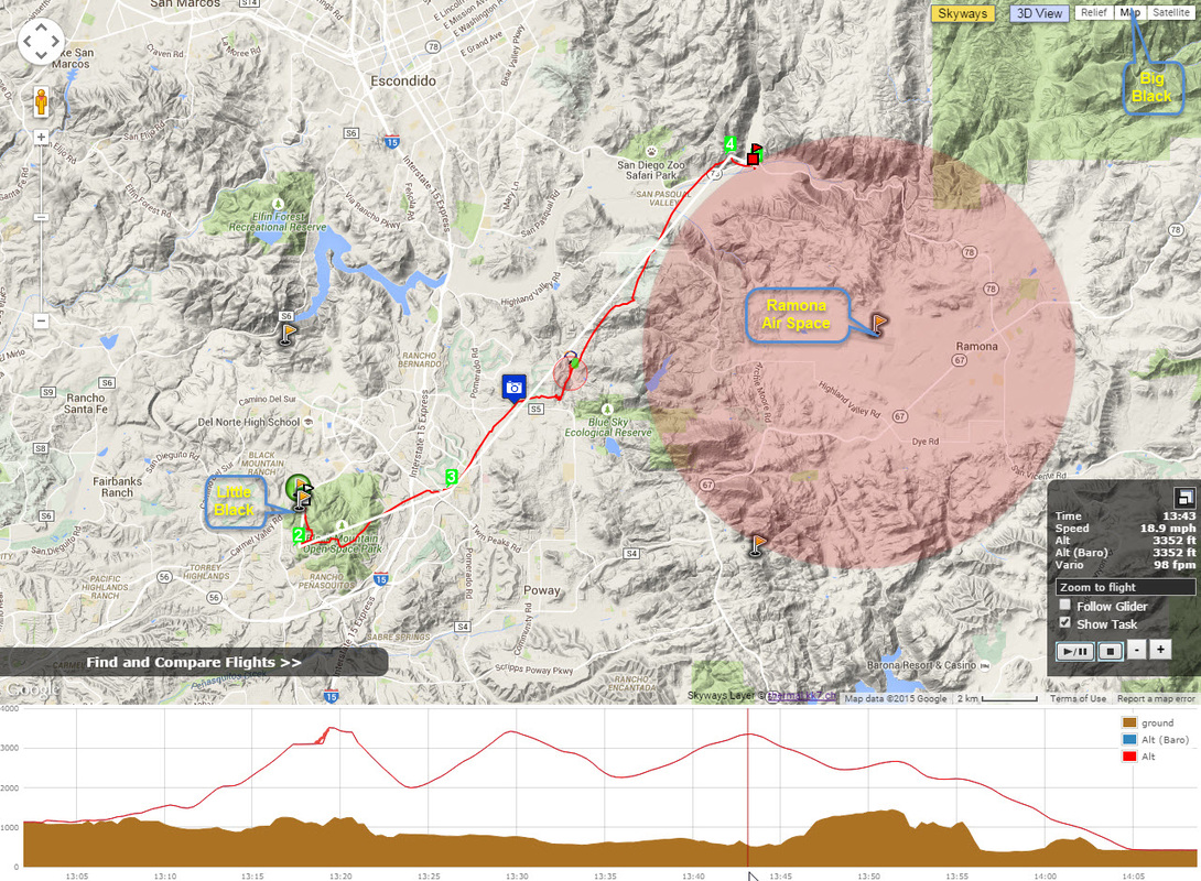
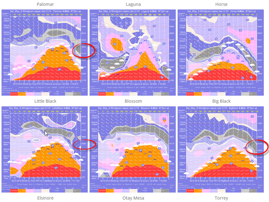
May 9th 2015 Flight Report by Steve Rohrbaugh
Little Black to San Pasqual Valley : 5-19-2015
The Thermal by Thermal
Track Log for the Day and the North XC Route out of Little Black
Some other Notable flights along this route making it to the San Pasqual Valley from Little Black with similar lines: http://www.paraglidingforum.com/leonardo/compare/1155133,831460,518775,315702,867622
Conditions we are looking for to Fly XC from Little Black:
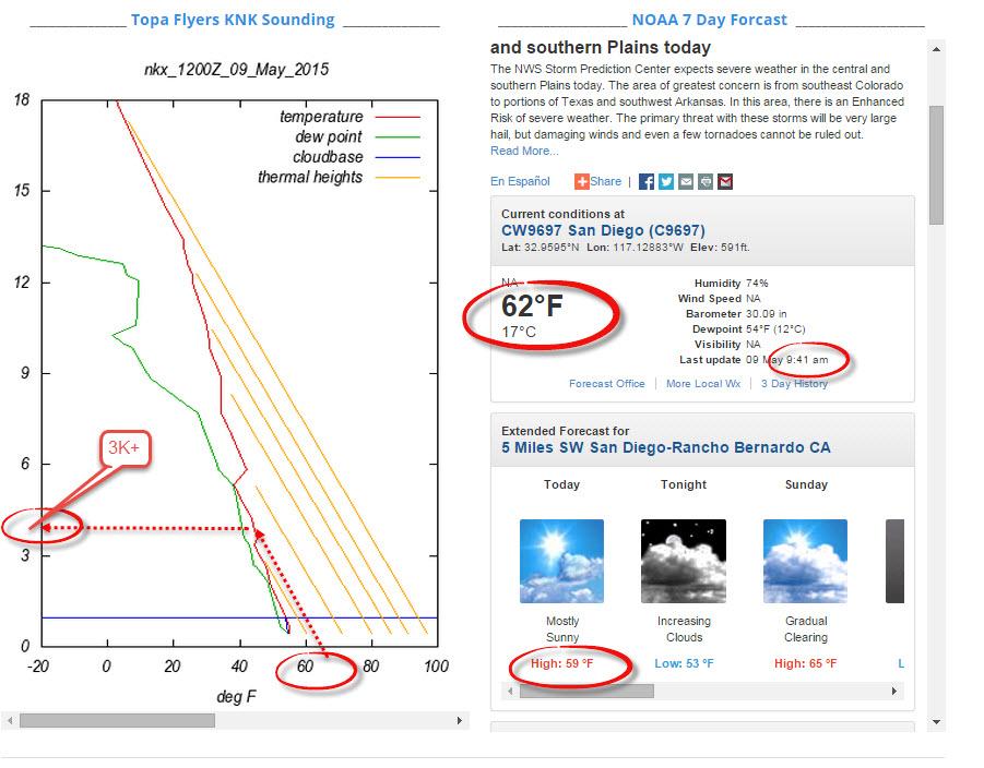
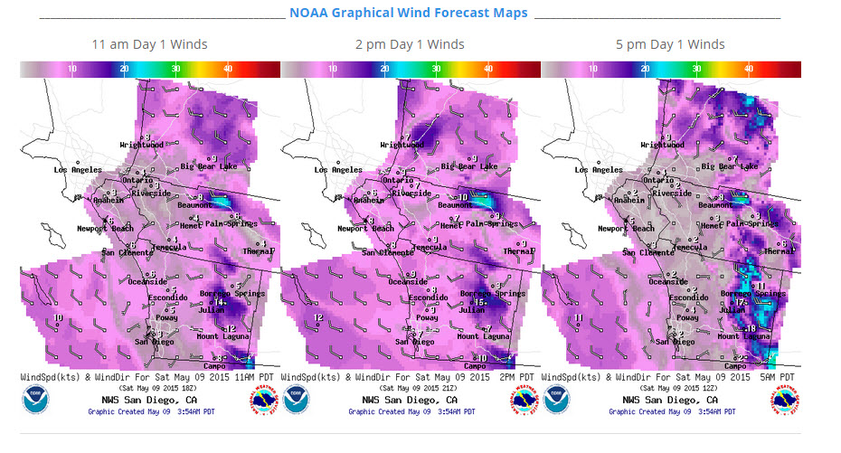
Screen Shots of 5-9-15 & Using theFlight Prediction tools on the SDHGPA WX Dashboard
|

SDHGPAThe San Diego Hang Gliding and Paragliding Association Categories
All
Archives
February 2024
|


 RSS Feed