
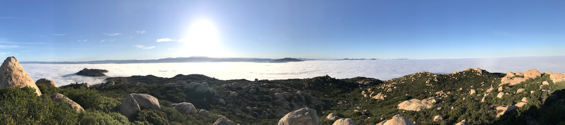
Many of us who fly the San Diego area could use a weather station at "The Cap". The Cap sticks up higher into the airflow than launch at Blossom, and a weather station there would help us make better calls on XC days as well as safety calls on those North-y days. Here's what you can do to help make an El Cap Weather Station a reality...
First, what is a weather station? We're talking about a Holfuy station, one that measures wind direction and velocity as well as a few other things.
We've got a few of 'em up around San Diego sites and we're one of the few clubs to be putting in serious weather stations like Holfuys. For this project, we're coordinating with The San Diego River Park Foundation to put in a weather station that will be useful to both us and them, along with providing information to other local agencies.
Coordinating with other entities is a huge part of the behind-the-scenes work that goes into setting these stations up. For any given project that we (or any free flight organization) do in conjunction with other entities we aim to make it a win for everyone. Whether us pilots are picking up trash at a site, keeping an eye out for trespassers, or, as in this case, adding to publicly available meteorological knowledge, it's vital that these projects be a win for everybody involved.
The SDRPF has done a few pretty wondrous things for areas we fly, including purchasing property and property rights on the Cap in order to keep it wild and undeveloped.
As part of the mutual benefits for this station, we're going to add a few sensors we wouldn't normally add in order for all parties (us, SDRPF, local agencies) to get max value out of this thing. We'll also be splitting the cost between us, so we end up with a more capable station at a lower price. Everybody wins, that's how we like it!
Proposed additional sensors (for you geeks out there) are:
All of those give both us free flying pilots and the other participating entities more data from which to make good decisions.
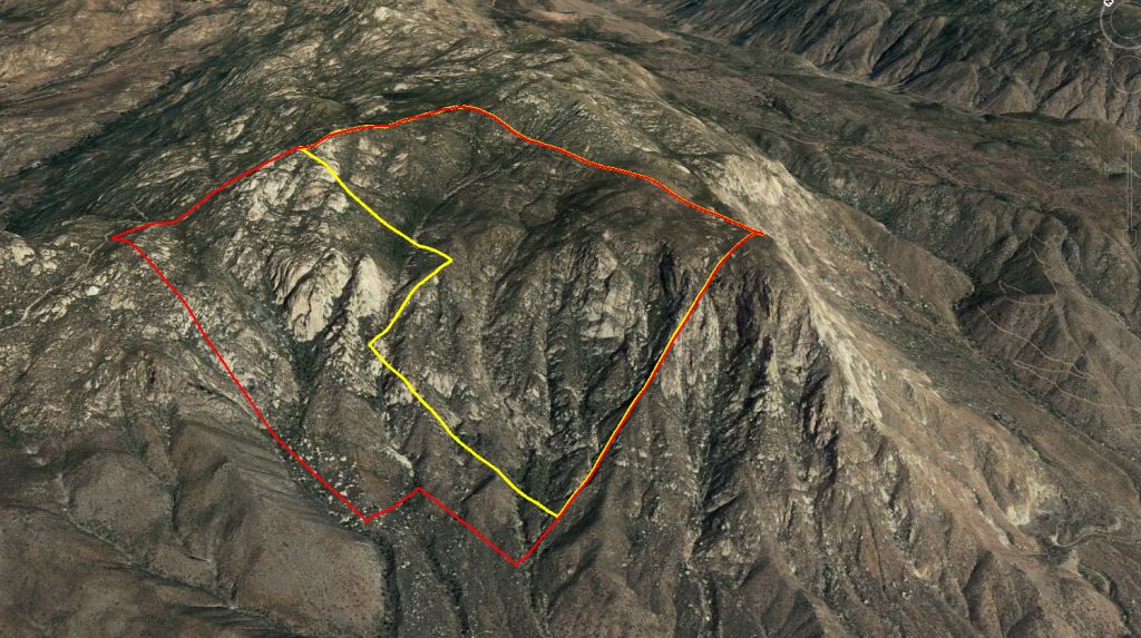
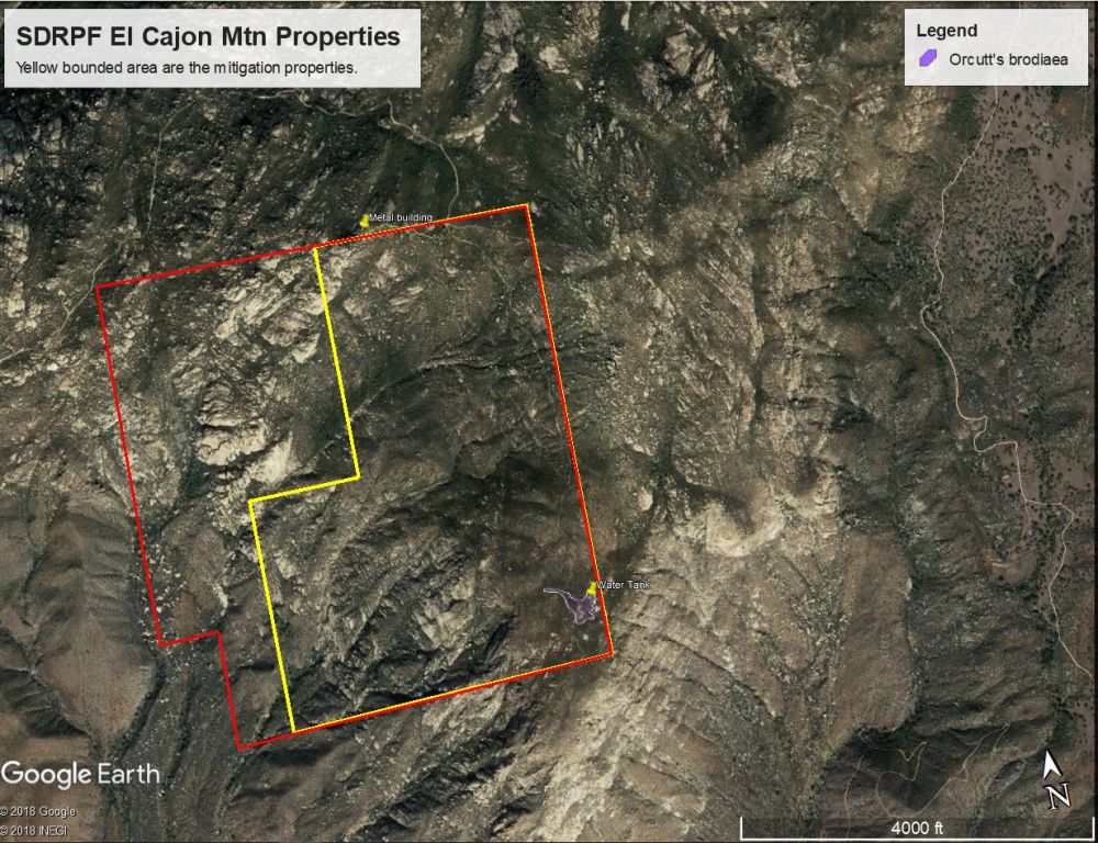
Second, we need to figure out where we'll put it. The San Diego River Park Foundation has generously agreed to explore putting it on land they have rights to out there. The following three images give an idea of where we *could* put a station.
Please go through these images, then use Google Earth to call out locations in the following format where you'd like to see a station:
32.902050, -116.824925
If you're super squared away, you'll also tell us WHY that's a good spot for a station.
Considerations:
We've got a few of 'em up around San Diego sites and we're one of the few clubs to be putting in serious weather stations like Holfuys. For this project, we're coordinating with The San Diego River Park Foundation to put in a weather station that will be useful to both us and them, along with providing information to other local agencies.
Coordinating with other entities is a huge part of the behind-the-scenes work that goes into setting these stations up. For any given project that we (or any free flight organization) do in conjunction with other entities we aim to make it a win for everyone. Whether us pilots are picking up trash at a site, keeping an eye out for trespassers, or, as in this case, adding to publicly available meteorological knowledge, it's vital that these projects be a win for everybody involved.
The SDRPF has done a few pretty wondrous things for areas we fly, including purchasing property and property rights on the Cap in order to keep it wild and undeveloped.
As part of the mutual benefits for this station, we're going to add a few sensors we wouldn't normally add in order for all parties (us, SDRPF, local agencies) to get max value out of this thing. We'll also be splitting the cost between us, so we end up with a more capable station at a lower price. Everybody wins, that's how we like it!
Proposed additional sensors (for you geeks out there) are:
- ultrasonic wind sensor (same as our other stations)
- humidity sensor
- rain sensor
- pressure sensor
All of those give both us free flying pilots and the other participating entities more data from which to make good decisions.
Second, we need to figure out where we'll put it. The San Diego River Park Foundation has generously agreed to explore putting it on land they have rights to out there. The following three images give an idea of where we *could* put a station.
Please go through these images, then use Google Earth to call out locations in the following format where you'd like to see a station:
32.902050, -116.824925
If you're super squared away, you'll also tell us WHY that's a good spot for a station.
Considerations:
- Is it in the best wind flow for helping free flight pilots?
- Is it in a place where casual passerby won't see it? There have been issues with vandalism out there, so out of sight is out of mind.
- Is it within the boundaries of where we can place it?

Please keep in mind none of this is guaranteed, and it'll take a fair amount of work, both paper pushing and old fashioned physical labor, to make this happen. If you want to volunteer to help, speak up!
-NFH@SDHGPA
-NFH@SDHGPA

 RSS Feed